
How ground-penetrating radar
actually sees underground.
No magic. No X-rays. Just physics — the same reflected-wave principle that lets a bat find a moth or a submarine find a coastline. Here is how it works, what it can see, and (just as important) what it can't.
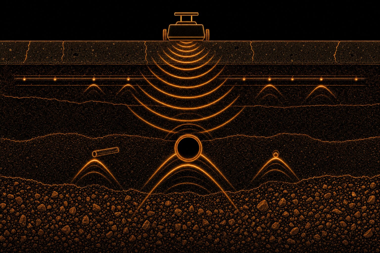
A GPR unit fires a short radio pulse into the ground and listens for echoes.
When that pulse hits a boundary between two materials with different electrical properties — concrete to rebar, soil to a plastic conduit, dry to wet — some of the energy bounces back. The unit records the time it took to return and the strength of the echo. Slide the antenna across the surface and you build a cross-section of the subsurface in real time.
On the screen it looks like a black-and-white waterfall. Every hyperbola (that little upside-down U) is a discrete object — a rebar, a conduit, a void. A trained tech reads those hyperbolas the way a radiologist reads an X-ray: pattern, depth, and context.
Six ideas that explain everything
Frequency = tradeoff
Higher-frequency antennas (1.6–2.6 GHz) see fine detail — a #4 rebar in a 6-inch slab — but only in the first foot or two. Lower-frequency antennas (200–400 MHz) see deep — 20+ feet in good soil — but with softer resolution. Picking the right antenna is 80% of the job.
Contrast is everything
GPR sees the boundary, not the object. It works because rebar's electrical properties are wildly different from concrete's. A plastic conduit surrounded by identical soil is much harder to see than the same conduit crossing from clay into gravel.
Water is the enemy
Wet clay, saltwater, and heavily reinforced concrete absorb and scatter radar. Depth gets crushed; noise goes up. That's why we scan concrete after it's cured, and why we tell you honestly when soil conditions will limit us.
The hyperbola tells the story
Point targets — a rebar, a conduit — always image as a hyperbola because the antenna picks them up at an angle before it's directly overhead. Read the shape and you get depth. Read a series of them and you get spacing, cover, and orientation.
Velocity calibration
Radar travels at different speeds in different materials. To convert time-of-flight to depth we calibrate on-site with a known target (a bolt at a known depth, a hyperbola shape-fit). Skip this step and depths can be off by 20–40%. We don't skip it.
Multi-method by default
GPR is powerful but not omniscient. For utilities we pair it with electromagnetic locators (great for energized lines) and acoustic tools (great for water). One method leaves gaps. Three methods overlap, and the overlap is where confidence lives.
Concrete, dry soils, and boundary-rich environments.
- Rebar, post-tension cable, and conduit inside slabs and walls
- Voids, honeycomb, and delamination in concrete structures
- Slab thickness verification
- Metallic and non-metallic utilities in reasonably dry soil
- Buried tanks, drums, and large-object recoveries
- Archaeological features (fill lines, foundations, disturbed ground)
- Cemetery mapping and unmarked-grave detection
Its limits — because you deserve the truth.
- Very wet clay soil dramatically shrinks depth range
- Densely reinforced slabs can mask deeper targets
- Non-metallic pipe in similar-density soil can be invisible without contrast
- Depth accuracy depends on velocity calibration
- Cannot identify what a target is — only that a target exists at a depth. Context, drawings, and multi-method locates confirm identity.
If a locator won't tell you where their tool struggles, get a second opinion. Every subsurface job has variables. What separates a good scan from a bad one is honesty about them.
Have a specific site you want scanned?
Tell us the slab thickness, the depth of interest, and the timeline. We'll tell you what we can find, how confident we'll be, and what it costs.